
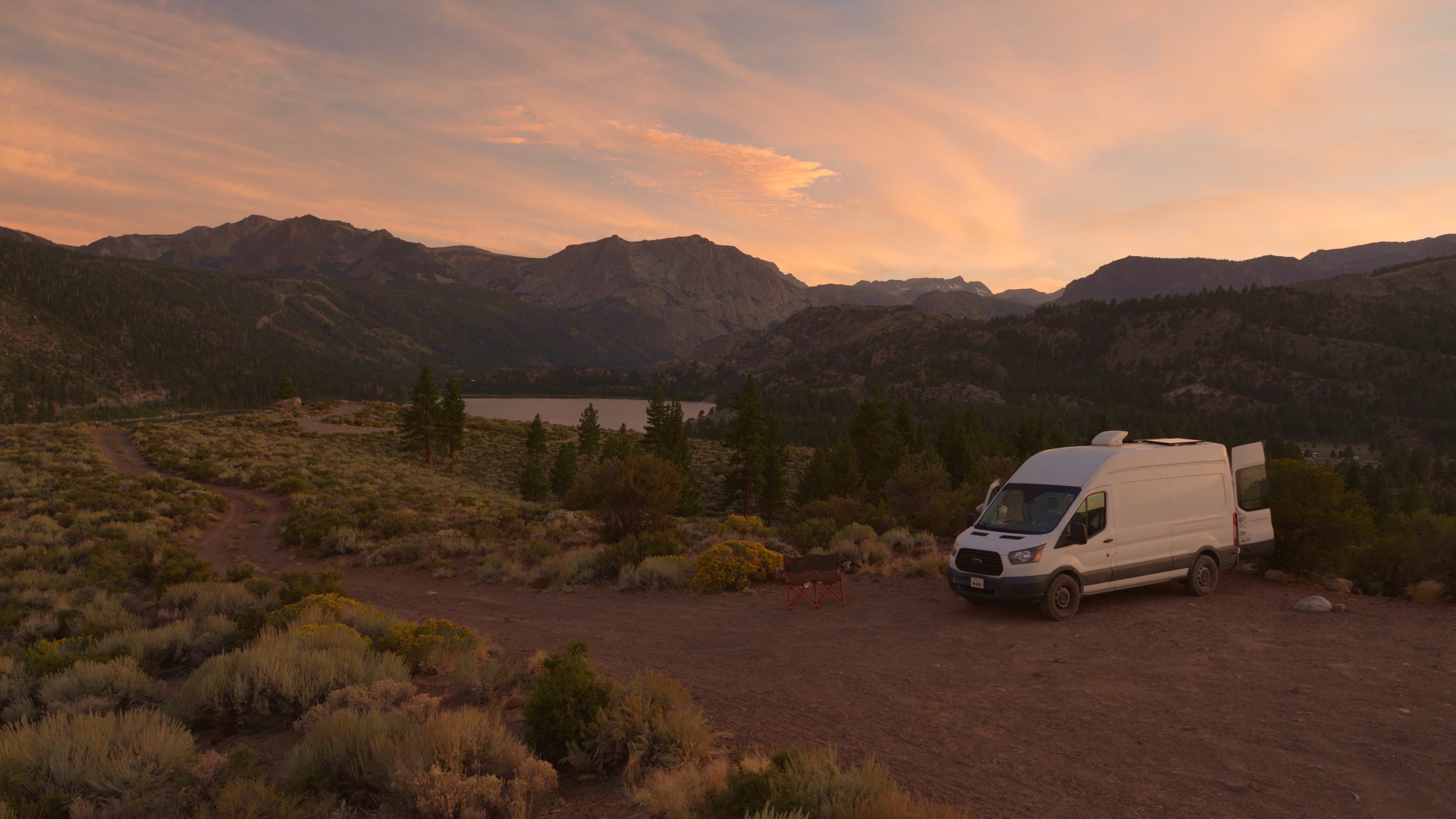
Find your perfect campsite.
Discover free and low-cost places to camp — plus the public-land boundaries, roads, and offline maps that get you there. Campgrounds, wild spots, RV parks, and backcountry sites, all on one map.
Watch
Welcome to Campsite
A quick look at app features, and why we built it.
- 50,000+
- Campsites to explore
- 3D Maps
- Public land + conditions
- Free
- Forever, for everyone
Features
Everything you need to find your next camp
From the first search to the last mile of dirt road, Campsite keeps the map, the details, and the community together in one place.
The map
An interactive map made for camping
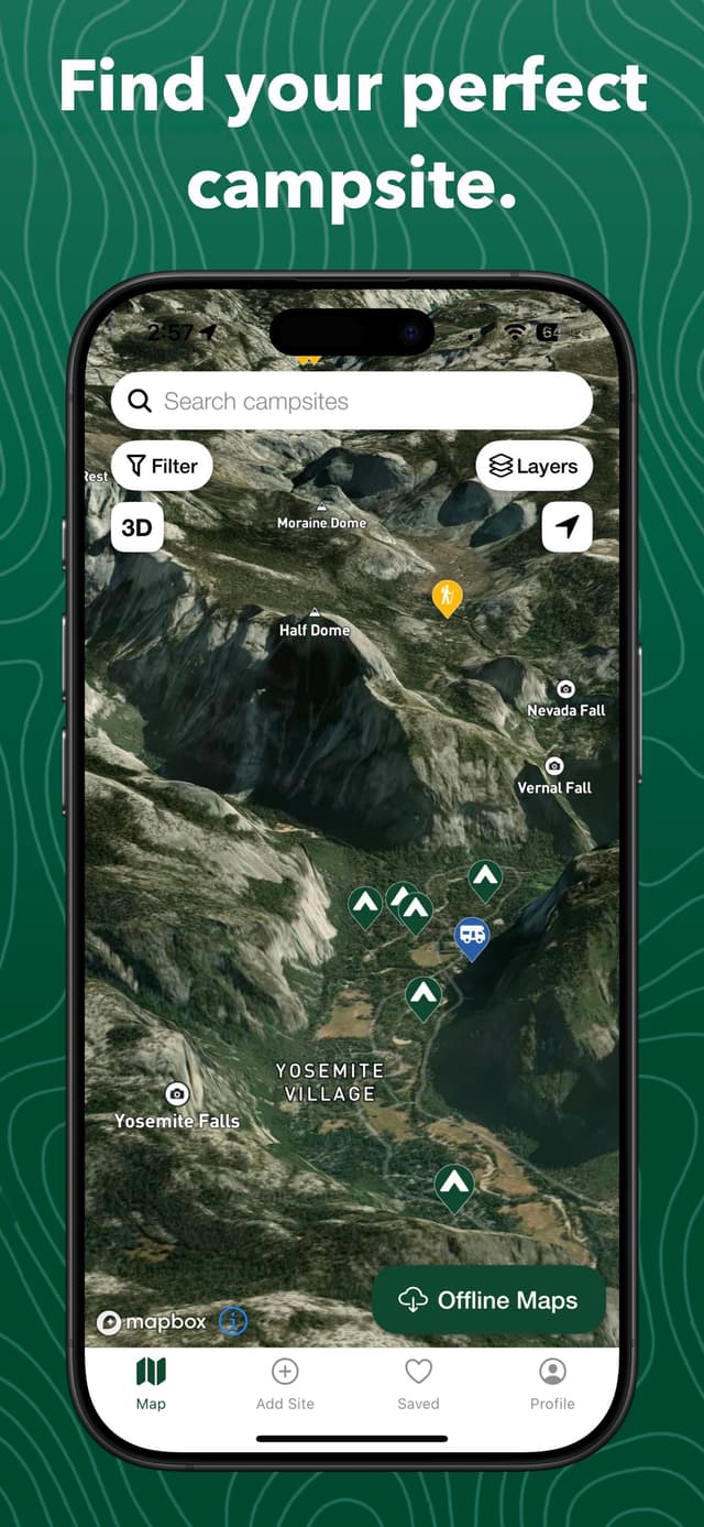
Pan a fast map with 50,000+ campsites on public land. Switch between satellite and topo styles, tilt into 3D, and tap any pin for a detail sheet with everything you need.
- 50,000+ campsites across the US
- Satellite & topo base maps
- Tap a pin for full site details
Layers
Turn on the layers that matter
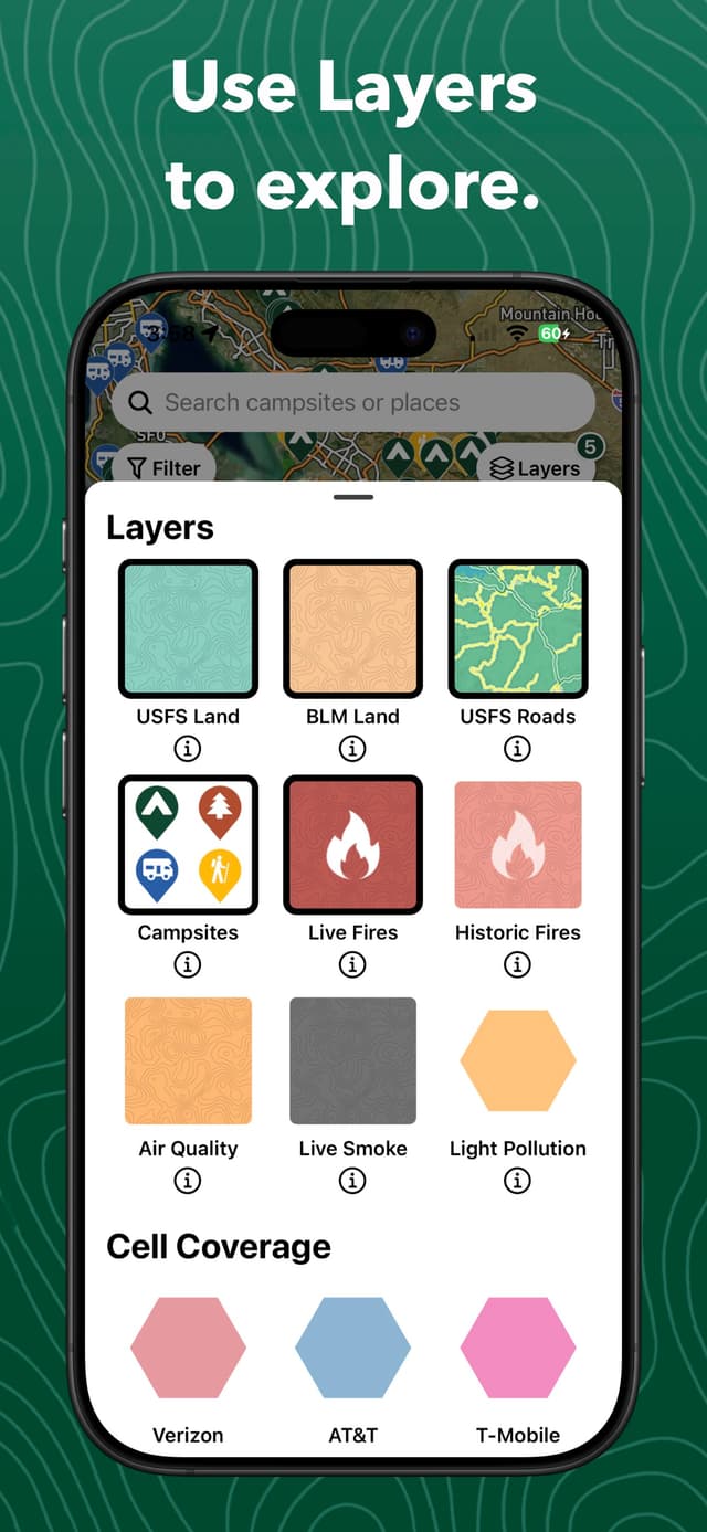
Open the redesigned Layers menu to overlay public-land boundaries, camping roads, cell coverage, and dark skies — plus live wildfire perimeters, historic fire areas, air quality, and near-surface smoke.
- USFS & BLM public-land boundaries
- Live wildfires, historic fires, air quality & smoke
- Cell coverage, dark skies & USFS roads
Site details
Know the spot before you drive out
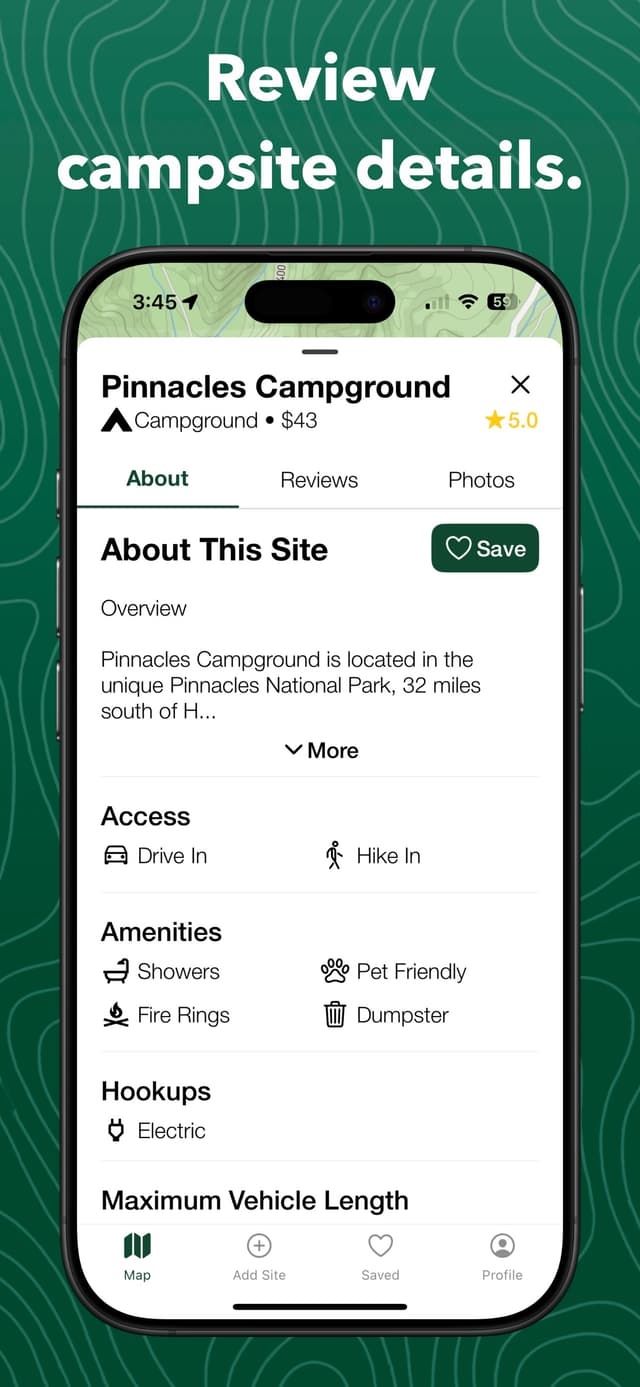
Every campsite carries the details that decide your night — cost, amenities, hookups, access, and warnings — plus community photos and directions to the pin.
- Nightly cost & site type
- Amenities: toilets, showers, water, fire rings, pets
- RV hookups: electric, water, sewer
- Max vehicle length, phone & website
Trip planning
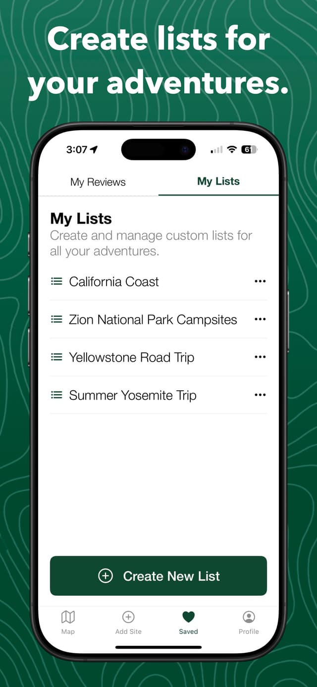
Custom lists for every adventure
Save spots into custom lists for different trips and regions, then view any list on the map to plan your route across public land.
- Organize spots into named lists
- View a whole list on the map
- Keep favorites close for next time
Off the grid
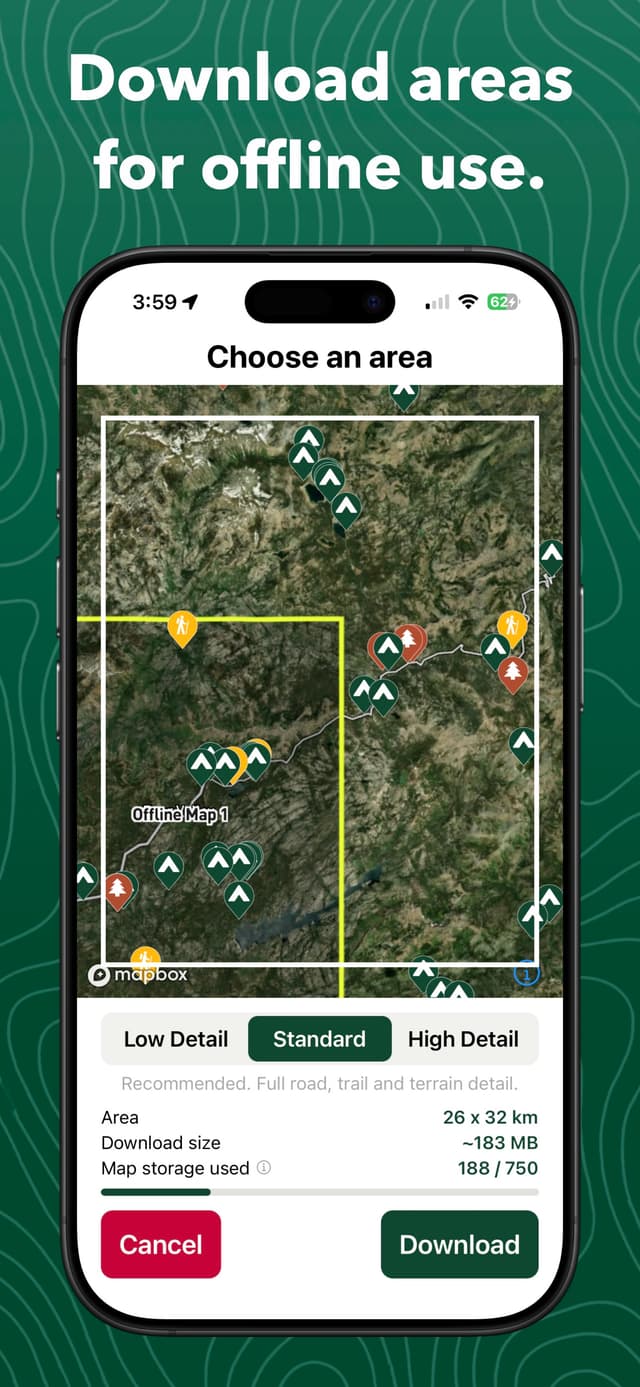
Offline maps for where the signal ends
Download map tiles and campsite data for a region before you leave, so your map and spots still work with no service. Offline downloads are the one perk reserved for Campsite Supporters — everything else is free.
- Download regions before you go
- Cached campsite data works offline
- A Campsite Supporter perk
One map, every layer
More than a pin on a map
From public-land boundaries to live wildfires, air quality, and smoke — Campsite puts the layers that shape a trip on one map.
Public land
USFS and BLM boundaries so you always know whose ground you're on.
Camping roads
USFS Motor Vehicle Use Map roads, color-coded by vehicle access.
Cell coverage
LTE coverage for Verizon, AT&T, and T-Mobile — know before you go.
Dark skies
A light-pollution layer to find the darkest skies for stargazing.
Live fires
Active wildfire perimeters and incident locations from NIFC, refreshed periodically.
Historic fires
Past wildfire areas so you can see where fire has burned before.
Air quality
Current EPA AirNow AQI contours so you know conditions before you go.
Live smoke
Near-surface wildfire smoke from NOAA HRRR-Smoke, refreshed hourly.
Every kind of camp
From full hookups to true backcountry
Browse every type of site on the web, or find them on the interactive map in the Campsite app.


And more
Search it, save it, share it
The little things that make Campsite the app you keep coming back to.
Search & filter
Find spots by name, place, or coordinates, and filter the map by site type.
Add & suggest edits
Contribute new campsites and suggest improvements to existing ones.
Share photos
Upload photos so the next camper knows exactly what to expect.
Free forever
The essentials are free — and always will be
The map, the layers, the reviews, the community — free forever, no account required to explore. Love the app? Become a Campsite Supporter to unlock offline map downloads and help keep public-land data free for everyone.
Your next campsite is waiting.
Free on iOS and Android. Download Campsite and start planning your next trip on public land.

